Gridpoints and grids
NWS forecasts use a nationwide 2.5 km × 2.5 km grid system. Each cell represents a small geographic area containing detailed forecast data accessible through the NWS API.
How grid assignment works
Each grid belongs to a Weather Forecast Office (WFO). When you provide a latitude/longitude to the /points endpoint, the API:
- Determines which WFO owns that location
- Identifies which grid cell contains the point
- Returns the grid identifiers needed to request forecasts:
gridId-WFO identifier (e.g.,BUF,OKX,LWX)gridX/gridY-cell's horizontal and vertical index within that WFO's grid
Use these values to construct forecast requests: /gridpoints/{gridId}/{gridX},{gridY}
Benefits
Grid-cell level forecasts provide:
- High spatial resolution-Fine-grained local forecasts
- Consistent structure-Uniform format across all WFOs
Visual example
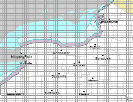
Figure: Buffalo NWS office (BUF) showing 2.5 km forecast grid cells with gridX and gridY coordinates
Next: Learn how to translate coordinates into Zones →